- Afhalen na 1 uur in een winkel met voorraad
- Gratis thuislevering in België vanaf € 30
- Ruim aanbod met 7 miljoen producten
- Afhalen na 1 uur in een winkel met voorraad
- Gratis thuislevering in België vanaf € 30
- Ruim aanbod met 7 miljoen producten
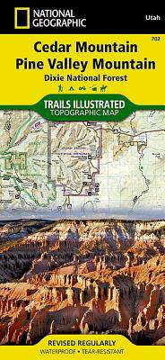
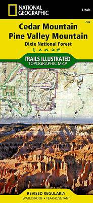
Cedar Mountain - Asdown Gorge /UT
Omschrijving
- Waterproof - Tear-Resistant - Topographic Map
Cedar City is the headquarters of the Dixie National Forest which is a two-million-acre, 170-mile stretch of breathtaking wilderness across southern Utah. This map covers the Markagunt OHV Trail System from the stunning Pink Cliffs in the South to the Parowon Valley Northwest to the town of Panguitch in the East, and the spectacular Markagunt Plateau Scenic Drive--a 123-mile trail from Cedar City to Parowan. Also featured are Cedar Breaks National Monument--with meadows at 10,000 feet and stunning nights for stargazing--as well as the shallow Navajo Lake, ideal for fishing, swimming, and boating, and the red limestone Hurricane Cliffs.
The area offers boundless outdoor recreation opportunities, from hiking, hunting, and horseback riding to skiing, swimming, and scenic driving--for all seasons, and a wide range of visitors. Recreation features are clearly marked, including trailheads, campgrounds, boat launches, mountain bike routes, ATV trails, downhill ski areas, scenic overlooks, and points of interest. The map includes contour lines, shaded relief, and elevations for summits and passes, as well as safety tips, visitor centers and ranger stations, and contact information for local agencies.
The printed map contains an inset showing greater detail of the popular Brian Head Ski Area and Cedar Breaks National Monument.
Every Trails Illustrated map is printed on "Backcountry Tough" waterproof, tear-resistant paper. A full UTM grid is printed on the map to aid with GPS navigation.
Other features found on this map include: Ashdown Gorge Wilderness, Brian Head, Dixie National Forest, Kolob Terrace, Little Salt Lake, Markagunt Plateau, Panguitch Lake, Parowan Valley, Pine Valley Mountain Wilderness, Pine Valley Mountains, Signal Peak.
- Map Scale = 1:75,000
- Sheet Size = 25.5" x 37.75"
- Folded Size = 4.25" x 9.25"
Specificaties
Betrokkenen
- Auteur(s):
- Uitgeverij:
Inhoud
- Aantal bladzijden:
- 2
- Taal:
- Engels
- Reeks:
Eigenschappen
- Productcode (EAN):
- 9781566953061
- Verschijningsdatum:
- 1/05/2020
- Uitvoering:
- Gevouwen kaart
- Formaat:
- Gelamineerd
- Afmetingen:
- 10 cm x 19 cm
- Gewicht:
- 91 g

Alleen bij Standaard Boekhandel
Beoordelingen
We publiceren alleen reviews die voldoen aan de voorwaarden voor reviews. Bekijk onze voorwaarden voor reviews.


