
- Afhalen na 1 uur in een winkel met voorraad
- Gratis thuislevering in België vanaf € 30
- Ruim aanbod met 7 miljoen producten
- Afhalen na 1 uur in een winkel met voorraad
- Gratis thuislevering in België vanaf € 30
- Ruim aanbod met 7 miljoen producten


Omschrijving
- Waterproof - Tear-Resistant - Topographic Map
Big Bend National Park is named for the large bend in the Rio Grande forming the park's southern boundary. Autumn and spring are popular times to visit due to the comfortable temperatures, but the higher elevations of the Chisos Mountains can provide some relief from the heat of the summer months (May and June are the hottest) and even a light dusting of snow on rare occasions.
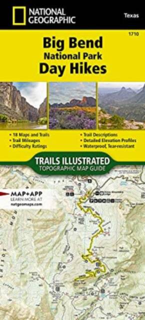
From its highest point at Emory Peak (7,825 feet), to its lowest at Rio Grande Village (1,850 feet), there is a hike for everyone to explore at Big Bend National Park. The 18 hikes featured in the Big Bend National Park Day Hikes Topographic Map Guide are organized by environments--Chihuahuan Desert, Chisos Mountains, and the Rio Grande--and range in difficulty and distance to help visitors select the best trail for their timing, abilities, and location within the park. Also included with each featured hike are directions to trailheads, an elevation profile, total elevation gain, and trail mileages.
Each of the 18 maps include directions to the trailhead, the total distance to complete the hike, and an estimate of the degree of difficulty. Also provided are elevations of key points on the trail, an elevation profile for the hike, and a calculation of the total elevation gained over the hike's course. Trail descriptions found on the next page will help you find the hikes that best suit your interests and conditioning.
More convenient and easier to use than folded maps, but just as compact and lightweight, National Geographic's Topographic Map Guide booklets are printed on "Backcountry Tough" waterproof, tear-resistant paper with stainless steel staples. A full UTM grid is printed on the map to aid with GPS navigation.
- Map Scale = 1:31,680
- Folded Size = 4.25" x 9.38"
Specificaties
Betrokkenen
- Auteur(s):
- Uitgeverij:
Inhoud
- Aantal bladzijden:
- 48
- Taal:
- Engels
- Reeks:
- Reeksnummer:
- nr. 1710
Eigenschappen
- Productcode (EAN):
- 9781566959063
- Verschijningsdatum:
- 27/06/2022
- Afmetingen:
- 107 mm x 239 mm
- Gewicht:
- 90 g


Alleen bij Standaard Boekhandel
+ 41 punten op je klantenkaart van Standaard Boekhandel
E-BOOK ACTIE


Beoordelingen
We publiceren alleen reviews die voldoen aan de voorwaarden voor reviews. Bekijk onze voorwaarden voor reviews.