
- Afhalen na 1 uur in een winkel met voorraad
- Gratis thuislevering in België vanaf € 30
- Ruim aanbod met 7 miljoen producten
- Afhalen na 1 uur in een winkel met voorraad
- Gratis thuislevering in België vanaf € 30
- Ruim aanbod met 7 miljoen producten


€ 117,45
+ 234 punten
Omschrijving
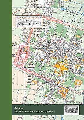
Following the success of volumes IV (Windsor and Eton) and V (York) in the series of Historic Towns Atlases, the new volume maps and explains the history of Winchester -- a city which has played such an important part in English history from Roman times onwards.
Combining many full-color maps with an authoritative but very readable text, the atlas shows how the Roman city of Venta Belgarum became the second-most important city in England for several centuries, a walled town, the seat of kings and an ecclesiastical center almost unparalleled in the country before gently declining into a judicial center and county town.
The atlas is centered on a detailed map of the city at the scale of 1:2500, showing Winchester's historic buildings and structures on a map of the city as it was in 1800. A series of maps show how Winchester was at key points in its history, charting its development and changing shape. The atlas includes an early OS map, modern maps and historic aerial photographs, as well as colour illustrations, many of which have never been published before.
The introduction offers a full history of how and why Winchester developed from prehistoric times onwards, in a series of chapters written by historians but aimed at the general reader. It also includes a comprehensive reference gazetteer listing every place shown on the maps, with a map location, a brief history, and further reading for those interested in finding out more.
Like its companion volumes, the maps, text, gazetteer and illustrations are presented in an A3 stiff card binder, and the format allows for maps of different date to be compared side-by-side.
Specificaties
Betrokkenen
- Auteur(s):
- Uitgeverij:
Inhoud
- Aantal bladzijden:
- 144
- Taal:
- Engels
- Reeks:
Eigenschappen
- Productcode (EAN):
- 9781785706660
- Verschijningsdatum:
- 20/12/2017
- Uitvoering:
- Hardcover
- Formaat:
- Genaaid
- Afmetingen:
- 305 mm x 432 mm
- Gewicht:
- 3061 g


Alleen bij Standaard Boekhandel
+ 234 punten op je klantenkaart van Standaard Boekhandel
E-BOOK ACTIE


Beoordelingen
We publiceren alleen reviews die voldoen aan de voorwaarden voor reviews. Bekijk onze voorwaarden voor reviews.