
- Afhalen na 1 uur in een winkel met voorraad
- Gratis thuislevering in België vanaf € 30
- Ruim aanbod met 7 miljoen producten
- Afhalen na 1 uur in een winkel met voorraad
- Gratis thuislevering in België vanaf € 30
- Ruim aanbod met 7 miljoen producten


€ 23,95
+ 47 punten
Omschrijving
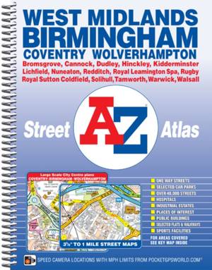
This spiral bound map of Birmingham and the West Midlands includes coverage of: -Birmingham-Coventry-Dudley-Solihull-Stourbridge-Walsall-WolverhamptonThe atlas includes 222 street map pages which extends to include: -Cannock-Lichfield-Tamworth-Atherstone-Nuneaton-Hinckley-Rugby-Royal Leamington Spa-Warwick-Kenilworth-Redditch-Bromsgrove-KidderminsterAlso included are large scale city centre maps of Birmingham, Coventry and Wolverhampton and a West Midlands rail and Midland Metro transport connections map.Postcode districts, one-way streets and safety camera locations with maximum speeds are featured on the street mapping.The index section lists streets; selected flats, walkways and places of interest; place and area names; National Rail and Midland Metro stations. There is a separate list of hospitals, NHS Walk-in Centres and hospices covered by this map.
Specificaties
Betrokkenen
- Auteur(s):
- Uitgeverij:
Inhoud
- Aantal bladzijden:
- 320
- Taal:
- Engels
Eigenschappen
- Productcode (EAN):
- 9781782570943
- Verschijningsdatum:
- 11/09/2015
- Uitvoering:
- Met spiraalrug
- Afmetingen:
- 190 mm x 260 mm
- Gewicht:
- 776 g


Alleen bij Standaard Boekhandel
+ 47 punten op je klantenkaart van Standaard Boekhandel
E-BOOK ACTIE


Beoordelingen
We publiceren alleen reviews die voldoen aan de voorwaarden voor reviews. Bekijk onze voorwaarden voor reviews.