- Afhalen na 1 uur in een winkel met voorraad
- Gratis thuislevering in België vanaf € 30
- Ruim aanbod met 7 miljoen producten
- Afhalen na 1 uur in een winkel met voorraad
- Gratis thuislevering in België vanaf € 30
- Ruim aanbod met 7 miljoen producten
Zoeken
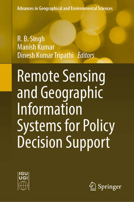
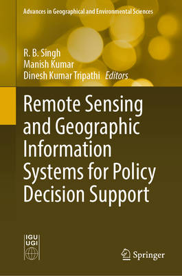
Remote Sensing and Geographic Information Systems for Policy Decision Support
€ 274,95
+ 549 punten
Omschrijving
The management of data to understand complex and interwoven processes of sustainable development has been a great challenge for researchers, planners, and decision makers. Remote sensing and GIS-based policy decision support systems not only help them to solve spatially related environmental and socio-economic issues; they also provide a powerful tool for integrating spatial and non-spatial datasets with analytical and spatial models and knowledge domains. Recent advances in the modern spatial tools of remote sensing and GIS combined with advanced computation techniques have enhanced the efficiency and capabilities of policy development. This book expands the scientific knowledge base in various physical and socio-economic issues among scholars, planners, and decision makers for policy development and research regarding sustainable development. It also demonstrates the importance of modern spatial decision support tools of remote sensing and GIS to better understand sustainable development processes and policy development. Furthermore, the book discusses case studies providing new insights as to how remote sensing and GIS-based decision support systems contribute to understanding physical and socio-economic processes and developing pragmatic policy for sustainable development.
This book covers land surface temperature, hydrological processes, terrain mapping, flood and landslide hazards, land use and land cover dynamics, crime hotspots, urban health issues, tourism, agriculture, forest management, flood mitigation, urban sprawl, and village information systems, among others. Readers will find this book to be an invaluable resource for understanding and solving diverse physical and human issues for policy development related to sustainable planning and management.
This book covers land surface temperature, hydrological processes, terrain mapping, flood and landslide hazards, land use and land cover dynamics, crime hotspots, urban health issues, tourism, agriculture, forest management, flood mitigation, urban sprawl, and village information systems, among others. Readers will find this book to be an invaluable resource for understanding and solving diverse physical and human issues for policy development related to sustainable planning and management.
Specificaties
Betrokkenen
- Uitgeverij:
Inhoud
- Aantal bladzijden:
- 497
- Taal:
- Engels
- Reeks:
Eigenschappen
- Productcode (EAN):
- 9789811677304
- Verschijningsdatum:
- 25/04/2022
- Uitvoering:
- Hardcover
- Formaat:
- Genaaid
- Afmetingen:
- 160 mm x 240 mm
- Gewicht:
- 1065 g

Alleen bij Standaard Boekhandel
+ 549 punten op je klantenkaart van Standaard Boekhandel
Beoordelingen
We publiceren alleen reviews die voldoen aan de voorwaarden voor reviews. Bekijk onze voorwaarden voor reviews.


