- Afhalen na 1 uur in een winkel met voorraad
- Gratis thuislevering in België
- Ruim aanbod met 7 miljoen producten
- Afhalen na 1 uur in een winkel met voorraad
- Gratis thuislevering in België
- Ruim aanbod met 7 miljoen producten
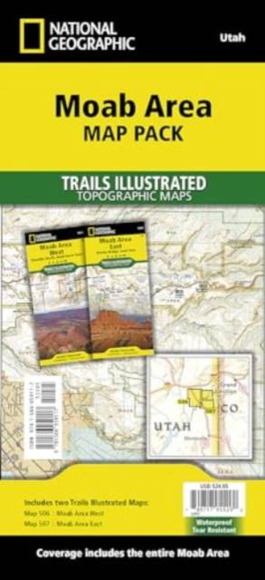
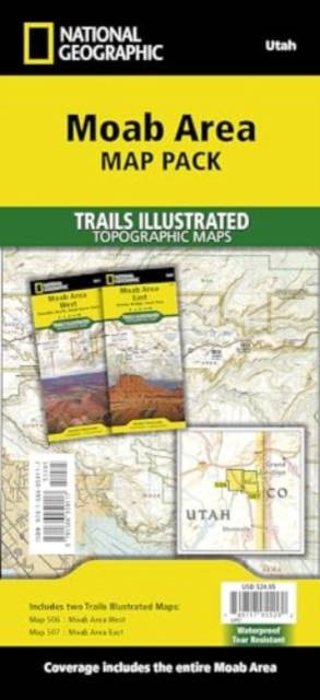
Moab Area [Map Pack Bundle]
Omschrijving
- Waterproof - Tear-Resistant - Topographic Maps
A premier destination for mountain biking, hiking, whitewater rafting, four-wheeling, and more, Moab offers adventure and recreation in one of the most iconic landscapes in the United States. National Geographic's Trails Illustrated maps of Moab were created in partnership with local land management agencies and adventure experts to provide unmatched detail of the area, with useful up-to-date information to guide and enrich your visit.
On the Moab Area East and West maps, particular attention is given to the area's extensive mountain bike trail systems, which are clearly mapped and labeled. Trails are symbolized by use (hiking, mountain biking, OHV), with trail difficulty indicated for mountain bike trails. Trail segments are labeled with distances between junctions, and all trailheads and trail junctions are labeled with elevations. 4x4 trails are highlighted in yellow with notes for obstacles and features along the route. Group, primitive, and developed campgrounds are shown with their amenities, and the total number of sites. Colorado River access points and mileages are mapped and labeled for river recreation. Visitor centers, interpretive trails, and scenic overlooks are prominently mapped and labeled with their amenities. OHV, biker, and desert safety tips, laws, and etiquette are also provided.
The Moab Area Map Pack includes:
- Map 506:: Moab Area West
- Map 507:: Moab Area East
Every Trails Illustrated map is printed on "Backcountry Tough" waterproof, tear-resistant paper. A full UTM grid is printed on the map to aid with GPS navigation.
- Map Scale = 1:90,000 & 1:37,500
- Sheet Size = 37.75" x 25.5"
- Folded Size = 4.25" x 9.25"
Specificaties
Betrokkenen
- Auteur(s):
- Uitgeverij:
Inhoud
- Aantal bladzijden:
- 4
- Taal:
- Engels
- Reeks:
Eigenschappen
- Productcode (EAN):
- 9781566959117
- Verschijningsdatum:
- 11/02/2022
- Uitvoering:
- Gevouwen kaart
- Afmetingen:
- 112 mm x 246 mm
- Gewicht:
- 204 g

Alleen bij Standaard Boekhandel
Beoordelingen
We publiceren alleen reviews die voldoen aan de voorwaarden voor reviews. Bekijk onze voorwaarden voor reviews.


