
Door een staking bij bpost kan je online bestelling op dit moment iets langer onderweg zijn dan voorzien. Dringend iets nodig? Onze winkels ontvangen jou met open armen!
- Afhalen na 1 uur in een winkel met voorraad
- Gratis thuislevering in België vanaf € 30
- Ruim aanbod met 7 miljoen producten
Door een staking bij bpost kan je online bestelling op dit moment iets langer onderweg zijn dan voorzien. Dringend iets nodig? Onze winkels ontvangen jou met open armen!
- Afhalen na 1 uur in een winkel met voorraad
- Gratis thuislevering in België vanaf € 30
- Ruim aanbod met 7 miljoen producten


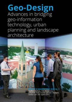
Geo-Design
advances in bridging geo-information technology, urban planning and landscape architecture
Steffen Nijhuis, Sisi Zlatanova, Frank van der Hoeven
Paperback | Engels
€ 24,95
+ 49 punten
Omschrijving
Geodesign is a GIS-based planning and design method, which tightly couples the creation of design proposals with impact simulations informed by geographic contexts. Geodesign as such comprises a set of geo-information technology driven methods and techniques for planning built and natural environments in an integrated process. It includes project conceptualization, analysis, design specification, stakeholder participation and collaboration.
This academic publication brings together a wide variety of contributions from authors with backgrounds in urban planning, landscape architecture, education and geo-information technology presenting the latest insights and applications of geodesign. Through focusing on interdisciplinary design-related concepts and applications of GIS international experts share their recent findings and provide clues for the further development of geodesign.
The book originated at the Geodesign Summit Europe (2014) held at TU Delft’s Faculty of Architecture and the Built Environment preparing grounds for in depth discussions and future collaborations. This is important since there is still much work to do. Not only in the development of geo-information technology, but especially in bridging the gap with the design-disciplines.
Specificaties
Betrokkenen
- Auteur(s):
- Uitgeverij:
Inhoud
- Aantal bladzijden:
- 248
- Taal:
- Engels
Eigenschappen
- Productcode (EAN):
- 9789492516428
- Verschijningsdatum:
- 2/01/2017
- Uitvoering:
- Paperback
- Afmetingen:
- 170 mm x 240 mm
- Gewicht:
- 528 g


Alleen bij Standaard Boekhandel
+ 49 punten op je klantenkaart van Standaard Boekhandel
E-BOOK ACTIE


Beoordelingen
We publiceren alleen reviews die voldoen aan de voorwaarden voor reviews. Bekijk onze voorwaarden voor reviews.