Bedankt voor het vertrouwen het afgelopen jaar! Om jou te bedanken bieden we GRATIS verzending (in België) aan op alles gedurende de hele maand januari.
- Afhalen na 1 uur in een winkel met voorraad
- Gratis thuislevering in België vanaf € 30
- Ruim aanbod met 7 miljoen producten
Bedankt voor het vertrouwen het afgelopen jaar! Om jou te bedanken bieden we GRATIS verzending (in België) aan op alles gedurende de hele maand januari.
- Afhalen na 1 uur in een winkel met voorraad
- Gratis thuislevering in België vanaf € 30
- Ruim aanbod met 7 miljoen producten
Zoeken
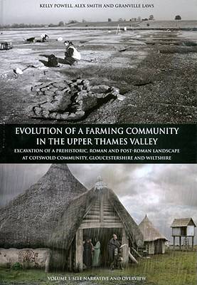
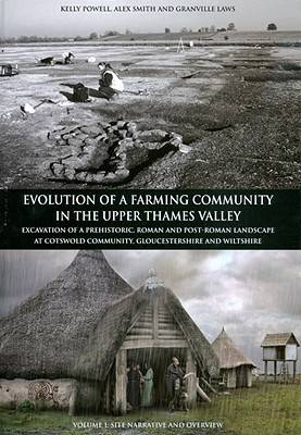
Evolution of a Farming Community in the Upper Thames Valley
Alex Smith, Kelly Powell, Alexander Smith, Granville Laws
€ 25,45
+ 50 punten
Omschrijving
The site at Cotswold Community in the western reaches of the Upper Thames Valley has been a focus for human activity since Neolithic times. Successive Bronze Age, Iron Age and Roman settlements developed within an increasingly open grassland landscape, which was heavily exploited for the growing crops and the grazing of animals.
Specificaties
Betrokkenen
- Auteur(s):
- Uitgeverij:
Inhoud
- Aantal bladzijden:
- 222
- Reeks:
Eigenschappen
- Productcode (EAN):
- 9781905905164
- Verschijningsdatum:
- 1/04/2010
- Uitvoering:
- Hardcover
- Afmetingen:
- 219 mm x 308 mm
- Gewicht:
- 1160 g

Alleen bij Standaard Boekhandel
+ 50 punten op je klantenkaart van Standaard Boekhandel
Beoordelingen
We publiceren alleen reviews die voldoen aan de voorwaarden voor reviews. Bekijk onze voorwaarden voor reviews.


