
- Afhalen na 1 uur in een winkel met voorraad
- Gratis thuislevering in België vanaf € 30
- Ruim aanbod met 7 miljoen producten
- Afhalen na 1 uur in een winkel met voorraad
- Gratis thuislevering in België vanaf € 30
- Ruim aanbod met 7 miljoen producten


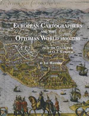
European Cartographers and the Ottoman World, 1500-1750
Maps from the Collection of O J Sopranos
Ian Manners
€ 53,45
+ 106 punten
Omschrijving
This lavishly illustrated catalogue of the exhibit European Cartographers and the Ottoman World, 1500-1750, explores how mapmakers sought to document a new geography of the Near East that reconciled classical ideas and theories with the information collected and brought back by travellers and voyagers. The text is accompanied by images of illuminated manuscript charts and atlases, the earliest printed maps of the Ottoman Empire, and bird's-eye views of cities that provided "arm-chair travellers" with the experience of knowing distant places.
Specificaties
Betrokkenen
- Auteur(s):
- Uitgeverij:
Inhoud
- Aantal bladzijden:
- 144
- Taal:
- Engels
- Reeks:
Eigenschappen
- Productcode (EAN):
- 9781885923752
- Verschijningsdatum:
- 31/12/2008
- Uitvoering:
- Hardcover
- Formaat:
- Genaaid
- Afmetingen:
- 229 mm x 287 mm
- Gewicht:
- 839 g


Alleen bij Standaard Boekhandel
+ 106 punten op je klantenkaart van Standaard Boekhandel
E-BOOK ACTIE


Beoordelingen
We publiceren alleen reviews die voldoen aan de voorwaarden voor reviews. Bekijk onze voorwaarden voor reviews.