
- Afhalen na 1 uur in een winkel met voorraad
- Gratis thuislevering in België vanaf € 30
- Ruim aanbod met 7 miljoen producten
- Afhalen na 1 uur in een winkel met voorraad
- Gratis thuislevering in België vanaf € 30
- Ruim aanbod met 7 miljoen producten


Omschrijving
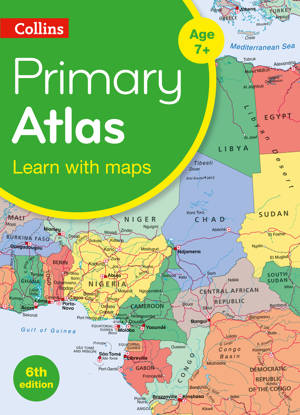
A curriculum-supportive Primary Atlas for children aged 7-11 years (Key Stage 2). Designed for use in the classroom or at home, this revised edition includes informative politically coloured reference mapping of all major world regions and relevant topics.
• This primary atlas provides an introduction to mapping of the UK, Europe and all major regions of the world. It includes information on map reading skills, the meaning of scale and measuring distances.
• The reference maps are informative, politically coloured, and easy to read with national capitals and major cities easily identifiable. The maps are supported with national flags and basic national statistics.
• Continental maps are linked to the regional mapping and are supported by a selection of aerial and terrestrial photographs. Continental relief maps show layer colouring and major physical features are highlighted.
Specificaties
Betrokkenen
- Uitgeverij:
Inhoud
- Aantal bladzijden:
- 68
- Taal:
- Engels
- Reeks:
Eigenschappen
- Productcode (EAN):
- 9780008417475
- Verschijningsdatum:
- 5/08/2020
- Uitvoering:
- E-book
- Beveiligd met:
- Adobe DRM
- Formaat:

Alleen bij Standaard Boekhandel
+ 5 punten op je klantenkaart van Standaard Boekhandel
E-BOOK ACTIE


Beoordelingen
We publiceren alleen reviews die voldoen aan de voorwaarden voor reviews. Bekijk onze voorwaarden voor reviews.