- Afhalen na 1 uur in een winkel met voorraad
- Gratis thuislevering in België
- Ruim aanbod met 7 miljoen producten
- Afhalen na 1 uur in een winkel met voorraad
- Gratis thuislevering in België
- Ruim aanbod met 7 miljoen producten
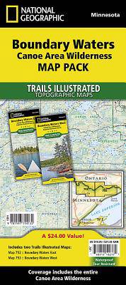
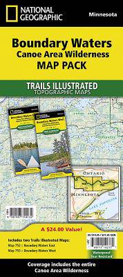
Boundary Waters Canoe Area Wilderness [Map Pack Bundle]
Omschrijving
- Waterproof - Tear-Resistant - Topographic Maps
The Boundary Waters was recognized for recreational opportunities in 1926, named the Superior Roadless Area in 1938, the BWCA in 1958, and federally designated under The Wilderness Act in 1964. It wasn't until October 21, 1978, The Boundary Waters Canoe Area Wilderness Act was established to provide specific guidance for managing the million plus acres of the Superior National Forest.
The BWCAW has changed little since the glaciers melted. With over 1,500 miles of canoe routes, nearly 2,200 designated campsites, and more than 1,000 lakes and streams waiting, the BWCAW draws over 250,000 visitors each year. As part of the Superior National Forest, the BWCAW is managed by the US Forest Service.
The two maps cover the entire map region with clearly marked hiking trails, portages, cross-country, snowmobile and snowshoe trails, trail access locations, campgrounds and tent sites, birding, fishing, kayak, canoeing and power boating opportunities. Some of the features found on these maps are: Ash River, Crane Lake, Kabetogama and Rainy Lake Visitor Centers, Gull Island Rookery, Grassy Bay Cliffs, Anderson Bay, Kettle Falls, Hoist Bay, and Gold Portage.
The Boundary Waters Map Pack includes:
- Map 752:: Boundary Waters East [Canoe Area Wilderness, Superior National Forest]
- Map 753:: Boundary Waters West [Canoe Area Wilderness, Superior National Forest]
Every Trails Illustrated map is printed on "Backcountry Tough" waterproof, tear-resistant paper. A full UTM grid is printed on the map to aid with GPS navigation.
- Map Scale = 1:70,000
- Sheet Size = 37.75" x 25.5"
- Folded Size = 4.25" x 9.25"
Specificaties
Betrokkenen
- Auteur(s):
- Uitgeverij:
Inhoud
- Aantal bladzijden:
- 4
- Taal:
- Engels
- Reeks:
Eigenschappen
- Productcode (EAN):
- 9781597754132
- Verschijningsdatum:
- 1/01/2020
- Uitvoering:
- Gevouwen kaart
- Afmetingen:
- 112 mm x 226 mm
- Gewicht:
- 204 g

Alleen bij Standaard Boekhandel
Beoordelingen
We publiceren alleen reviews die voldoen aan de voorwaarden voor reviews. Bekijk onze voorwaarden voor reviews.


